Friday, 1 April 2016

Rann Odyssey

I always wonder why we love to travel, and the reason might be found out by only more and more travelling. This time our destination was India’s western most state of Gujarat. It was the summer time (as far temperatures in Rann of Kutch are concerned) of March end; two of us (Vikas and Rohit) decided to have our bikes and body get tested the taste of extreme heat. Our target was to explore Great Rann of Kutch and Little Rann of Kutch.


Route :
Mumbai – Ahmedabad – Viramgam – Dhrangadhra – Malia – Samkhiyali – Bhachau – Bhuj – Bhachau – Samkhiyali – Lakadia – Chitrod – Palasava – Zinzuwada – Zainabad – Viramgam - Ahmedabad – Mumbai


We started the journey from Mumbai on 23rd March evening at around 5:30 evening and drove straight to Surat city for having our dinner. We ate splendid delicacies of some food variants. I must admit that once in a lifetime all should visit Surat city for greater food experience and am sure people will fall in love with the varieties and taste. After having our dinner at around 11 in night, we headed to Bharuch and took a room in hotel Sarvottam, located somewhere approx 2 kms after Bharuch on NH8. Location of hotel Sarvottam and its rooms are good, considering 800 bucks for double AC room.


On 24th March early morning, we took our breakfast and started our bikes to cover the distance till Bhuj in time. I must praise Gujarat govt. for developing such magnificent roads in entire state.  Rohit was busy in entire route clicking pictures of excellent highways of Gujarat, while mostly I was busy in riding my bike steadily at 120 kms per hour. By 5:30 in evening, we reached Bhuj, our base for next 2 days. We headed straight to BSF Sector Headquarters to collect our permit for Vighakot. Vighakot is also referred as Zero Point and is last border post on India-Pakistan international border assessable to civilians. For visiting this point, one needs to have permit. It’s mentioned in various sources, that it would take less than a week's time for permits. Infact, it took us 15+ days for the complete permit procedure. Since we were travelling from Mumbai, we thought not to take chance and applied for border visit permit in advance by 20 days. After collecting our permit for Vighakot, we went to our hotel and rested for the night.


On 25th March, we started early in the morning at around 6:30 AM. This was required since we were to cover Kalo Dungar, India Bridge, Vighakot and Dhordo and time constraint was a major factor. The distances from Bhuj includes approx 80 kms India Bridge and approx 177 kms Vighakot. For visiting India Bridge, tourists don’t need permit but they can’t go beyond this point. If you are visiting Vighakot, it’s mandatory to return back to India Bridge before 6 PM and hence we went directly to India Bridge to proceed to Vighakot with permits. Photography is not allowed before and after India Bridge. The BSF personnel’s will warn you for this before entering India Bridge. After crossing India Bridge, we stopped at BSF post to show our permit. The original permit was retained by the officer in Charge and information was mentioned in register with our ID particulars. As per rules, we kept our mobiles and cameras with them. We were courteously given description about the route by the officer and were strictly warned not to miss the route and divert into Rann, else we will find ourselves nowhere as the Rann route is very much complicated. To our luck, we found 2 electric contractors going towards one of the BOP’s at border area and both of them agreed to accompany us to show the route. After covering approx 10-12 kms, we stopped at Dharmshala post, where we were again required to enter our arrival details in register maintained there. After entering our details, two of us went ahead with the electrical contractors. Just after crossing the post area, the two guys left the road head and diverted left to ride in middle of the Rann. This drive of approx 15 odd kms through Rann was scary and at the same time mind blowing. On both sides of the road head we could sense water at the horizon, but it was only an illusion. The entire stretch is uninhabited except finding BSF personnel’s. After covering distance of approx 80 kms, we reached Vighakot post at around 11:30 AM. We were given warm welcome by the officer in Command and were given free service of an officer to gain knowledge about the place. While we were busy in exploring India-Pakistan border, we were given special service by BSF offering Water and TEA in a tray. It was an awesome feeling as we were sitting in a hotel and the waiter was carrying all the things in a tray to serve us. We can’t forget this nice gesture of theirs in our entire life. After a while, we took our pre-ordered lunch and restarted out journey back to India Bridge at around 2 PM. We felt privileged as we could visit a border post where most civilians doesn’t think of going and definitely it was also a proud moment for us to interact with BSF and gain knowledge about our nation, India. We were lucky enough to get in close at the border fence and to pillar no 1111, the point where officers from both sides holds flag meeting every three months. Since time was less, we skipped Hanuman Temple some 20 kms approx from Dharmshala post and reached India Bridge at around 4 PM. We took our luggage kept at the post and went to Kalo Dungar. This is probably the only place in Kutch from where a panoramic view of the Great Rann of Kutch is possible. Since it is located very near to the Pakistan border, there is an Army post at the top; beyond here, only military personnel are allowed. This is the place one can have a miss as it was not at all worth to expectations, as per us. At around 5 we left for Dhordo, the place from where one can see miles of White Rann (White Desert). To visit Dhordo one needs permit which can be obtained from Bhirandiyara.  We took some nice snaps of sunset on White Rann and went back to Bhuj at around 9 PM. We were to stay at White Rann till late in night to have night photography under moon, but to our utter disappointment the moon came visible very late and till then we had already left the place in frustration.


On 26th morning, we left early to visit Little Rann of Kutch. We took Bhachau-Palasava route. Palasava is a small village where you can’t expect food facilities, hence prepare yourself in advance for welcoming adverse situations. Traversing Little Rann of Kutch from Palasava to Zainabad is almost 100 kms long distance and is mostly uninhabited. Just fuel up your tank before Palasava, have enough food and water supplies with you, get knowledge of repairing bike in middle of no man’s land and, that’s all. Good old man, in Palasava village bus stand, guided us to starting point of Rann and there we were. It was scary ride till 2-4 kms with average speed not going over 10-20 kms per hour, as the stretch was having much sand and driving in sand was difficult as bike skidding was a major threat to us. After a short drive, there came the trail stretch having almost no sand and here we started to go beyond 80 kms per hour. Enroute we stopped at Vachhraj Temple, some 30 kms before Zinzuwada exit. There was a pond near the temple, and by every means this may be the best birding spot. After spending almost half hour, we headed towards Zinzuwada. We also cited some Wild Ass enroute. One can plan well in advance to make sure for a good safari organised through their hotel or resort, to have better glimpse of wild life in Little Rann. We were not lucky enough as were short of time and couldn’t experience more in little Rann. Importantly, one shouldn’t miss the trail road as you may find up yourself left deserted with unidentified trails in middle of the Rann. There are some pillars and flag markings on the main trail which keeps guiding you throughout the route. Visiting Little Rann of Kutch requires permit. Permit can be obtained from Zainabad or can be arranged through your hotel. Permit can also be obtained from Bajana, another route to enter Little Rann. Bajana is some 20 kms before Dhrangadhra. Good resort options as well forest department’s camp sites are there at Bajana and Zainabad.


After exiting Zinzuwada we went through to Viramgam - Ahmedabad - Mumbai route, halted near Vadodara for night and on 27th afternoon reached Mumbai with mesmerising memories of the trip. We were not so much happy as just 2 days were not enough for experiencing entire Kutch and surely will plan more for Kutch in near future. The total distance covered by us on bike was approx 2240 kms.

That’s all folks, for now.. Over to my routine life with office.. Errrrrr.


Wednesday, 24 June 2015

Lamkhaga Pass Trek - The Himalayan Adventure Saga

The Lamkhaga Pass (17300 ft) is a fairly remote and one of the most challenging trek, surrounded by snow capped mountains, glaciers and streams. This beautiful trek takes you through some of the most remote areas of Himachal Pradesh and Uttarakhand.

We, the Mumbaikars, this time decided to have something tricky achievement in our pockets by crossing Lamkhaga Pass. The Pass having approx elevation of 5300 meters is a strenuous trekking expedition, believed to be more difficult from Kinnaur side. The Lamkhaga Pass trekking expedition starts from Chitkul, Himachal Pradesh and ends in Harshil, Uttarakhand. The period was around Dec'14 when our group of 5 peoples from Mumbai decided to accept the challenge. Then it came to search other participants. The challenge was to create a team that's strongly aligned to the common purpose and it was not a tedious job as Facebook and other blog websites helped to get the job done sooner.

The team was set. I referred as Vikas, Rohit, Vishnu, Aaditya, Durgesh all from Mumbai, Karan from Chandigarh, 2nd Aaditya from Chennai, Smita from Hyderabad and Rashmi from Bengaluru were the team members who hailed from different fields of Job and Business. The diversity and size of the team was a challenging factor to get the team united for the purpose as some were already experienced whereas some were laymans, however it was a motive that provided sufficient courage to go for it. Apart from 9 member's team of trekkers, in total there were 21 members involving guide, cook, support staff and porters.


The itinerary we were to follow was a result of extensive research done by Rohit, the master mind, and was backed by our trek organizer Raacho Trekkers. The brief itinerary can be summarized as below:

Trek Duration:  29th May'15 to 5th June'15

Trek Route       :           Chitkul - Nagasthi - Rani Kanda - Dumti - Nithal Thatch - Base Camp (Chitkul Side) - Advance Base Camp - Lamkhaga Pass - Base Camp (Harshil Side) - Sukha Taal - Kyarkoti - Harshil


To get completely acclimatized, and as per plan, the team members one by one made their way to Kalpa and Reckong Peo via Shimla between 26th-27th May'15. Rohit, Vishnu, Aaditya, Durgesh and Smita reached Chandigarh airport on 25th May and took a cab all the way to Kalpa halting a night in Shimla where 2nd Aaditya joined them. I reached Chandigarh on 26th May and since I was alone, I took bus from Chandigarh to Kalpa. Since taxi cost would have taken a toll on me I decided to go by HRTC bus, which even proved fatal for me as it was worst country side journey I took till date. The roads condition was very bad and due to time constraint I boarded in HRTC ordinary bus not even allowing me to sleep the whole night. The driver of the bus was continuously playing Daler Mehndi’s Tunak Tunak Tun and by morning I memorized each and every word of the song. Rashmi and Karan joined us directly in Chitkul.


After the eventful pre-trek phase we finally set out for expedition to be remembered lifetime. By the time acclimatization process got completed in Kalpa/Reckong Peo and everyone reached Chitkul, Aaditya from Chennai already got hit by AMS; however he continued to try for the task. At last the day came when our endurance was to be put on a great test. The drive from Chandigarh airport to Chitkul via Shimla was enormously tiring due to roads bad condition and since everyone had already passed a tiring journey, the endurance, we believe, was not much left with anyone. The motive, was however clear to clear the pass, all group members started the journey of lifetime from Chitkul.

On 29th May'15 morning, the team started from Chitkul following a trail on banks of Baspa River to reach Nagasthi. It was not an easy start for Rashmi as en route she discovered her shoes to be torn apart from shoe sole and she decided to go further by using sandals. Soon we crossed the local ITBP post where we were glared with an enemy look by the military personnel's but since all our permits were taken in advance we didn’t find it difficult to cross the section. After a walk of around 4-5 hrs we finally reached our day 1 camp site at Rani Kanda and alas, it was a sigh relief. We were having a professional hired photographer with us, Mr. Nishchay, who after reaching campsite started his camera to capture the moments. We also clicked some good pictures and ended the day with sweet notes.


On day 2 we had our breakfast early morning and started our onward journey towards Dumti, our next campsite. It was a beautiful trail comprising of boulders and steep hike across banks of Baspa river. By the time half a distance was covered over risky zone of Lal Dhang, it was very much clear that Aaditya was hit by AMS and he was needed to be rescued immediately. Till this time the weather started deteriorating and soon it started to receive heavy snowfall, further worsening the progress of the team. Heavy snowfall, falling pebbles, steep hike, chilly winds, were all part of our journey, somehow everyone managed to get themselves into the campsite at Dumti at around 2:30 PM, just next to ITBP camps. Gosh, it was a wonderful campsite with a cricket ground maintained by ITBP personnel's and despite of the lost energy our team enjoyed playing cricket with ITBP personnel's at such a great height on mountains well above 4000 meters. By this time Aaditya, who was hit by AMS was escorted to ITBP camp with the help of porter where he was given emergency aid and was strictly advised to return back, leaving only 8 of us to conquer Lamkhaga pass. The hospitality extended by ITBP Jawan's was to admire, as we were served with hot tea just like home and we were allowed to even make phone calls, though, at some little cost. We didn’t missed the opportunity to click pictures in night; however, the severe cold halted our ambitions to get some good clicks.


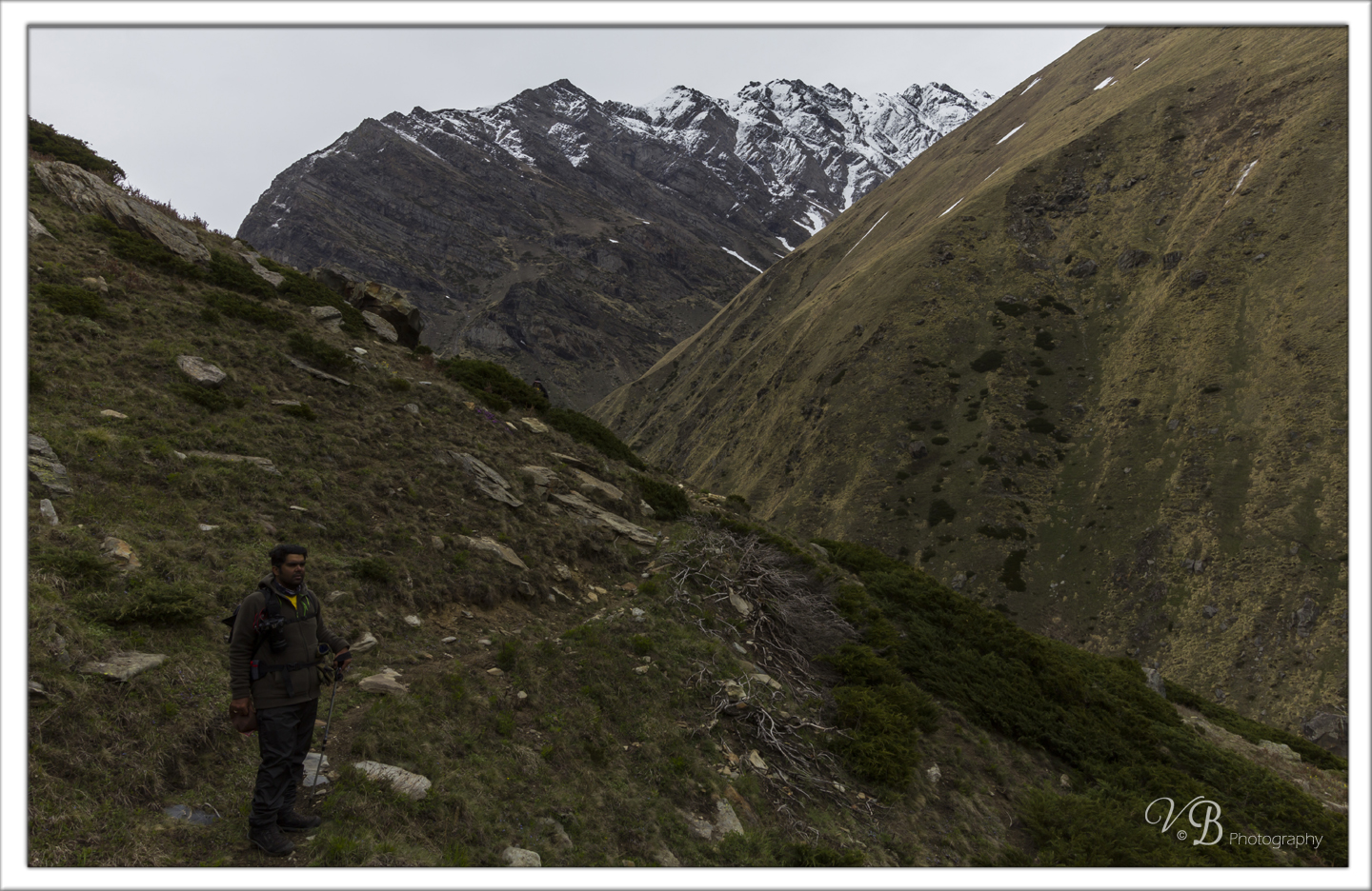
The 3rd day of trek was to say goodbye to Aaditya way back home. After breakfast, we decided to take blessings of Karu Devta at Dumti temple, participated in Pooja Ceremony with ITBP personnel's and started our journey towards Gundar. The trail eased up soon and it was looking like a flat farmland with little ice fields in between. The route ahead was predictably smooth, over gradually rising plateus and moraines. The route was still going on the left bank of the Baspa river. It was like a wide valley with snow capped mountains on both sides guarding us. After walking around 5-6 hrs we crossed another local ITBP post at Nithal Thatch, passed a small stream ahead and reached our campsite. This was believed to be the last patch of greenery and now we were to enter into complete snow zone. After relaxing for a while, we took a small acclimatization hike on a nearby peak. By this time the weather again worsened and it started heavy snowfall which lasted the whole night. Then came the morning and we found our tents drenched in snow. The early morning sunrays were about to hit the peaks and we immediately captured the moments in our cameras. We were experiencing a new powerful force enlightening our inner souls and energy.


The time was now to head towards Lamkhaga Pass base camp, but after walking a couple of kilometers our team encountered heavy downpour and it looked almost impossible to walk further. Our guide decided to put our tents immediately so that we can get ourselves protected from cold and harsh weather. Our buffer day was utilized here. The downpour lasted till 6 in the evening. The weather got cleared in late evening allowing us to have our dinner comfortably. During dinner we decided to move further in night itself since the weather was predictably worsening between 10Am to 5 PM. We started our journey towards base camp at 4 AM next day. It was getting hard to cover the distance due to severe chilly atmosphere and extreme darkness followed by boulder area. After walking a little, the sky started showering light on us as the sunrays were about to hit. Once the sunrays enlighted the sky, the Baspa valley was looking like jewel made of ice with thin snow ridges on both sides of the valley. After a little while we reached the end of the flowing Baspa, overlooking the Baspa Glacier. At extreme right we could sense an opening, the gateway to the Lamkhaga Pass. This was the place where our base camp was supposed to be fixed, but since already we had lost buffer day and there was a fear of getting the weather again worsen, we decided to skip camping in Baspa valley and headed straight towards advanced base campsite. The idea was to get to the ABC by later afternoon but oh man, it was really looking like mission impossible as our real endurance test was to begin now. The walk along the gateway to Lamkhaga Pass was steep hike of approx 800 meters in snow almost covered up to knee height at many places. Crossing ridges after ridges, the Chhotkhaga Pass and Lamkhaga Pass became clearly visible and appeared to be in touchable distance. Chhotkhaga Pass shortens the journey to Kyarkoti but the Pass is extreme steep and very much difficult to cross. After hiking approx 400 meters I angrily asked our guide how much time it will take more to reach the campsite as we had already covered a long distance since morning and now our energies were almost frozen up like ice. The worst part, it started snowfall again but for a little while but the harsh winds continued. The vertical slopes seemed unending. Every now and then one of us would slip into some unseen hole in the snow. I was tempted to be ahead of all, but found myself walking behind everybody taking a breather almost every minute. We were closing to the 5000 meter mark and now it was realizing that the altitude had begun taking its toll. Our prayers answered and negotiating the final snowfield for about 6-7 hrs we reached the advanced base camp site. The view overlooking the Lamkhaga Pass Ridge was just like a National Geographic documentary. We were feeling like in Antarctica as the surroundings were completely covered with white snow. The wind's speed at ABC was such extreme that it was getting very hard for our team to set up the tents. It was completely looking like white-out due to hard chilly winds and snowfall. Somehow our team managed to get the tents ready, putting our worries to a little rest. It was really a bad day for us as we haven't taken lunch and even walked a long way without proper arrangement of water. We were feeling like when this trauma will end. It was kind enough of our support staff who served dinner in our tents itself so that we can avoid the harsh weather outside. The night was pleasant as snowfall stopped and sky got cleared, however chilly winds didn't stopped.


Day 6, the day of summit, we woke up early morning to hear bad news. It was heavy snowfall outside, the weather started deteriorating. We were still inside our tents as no one had the courage to go outside and brace the weather. Since the weather was not clear at all, it looked dangerous to cross the pass and we were given option to return back. The first thing came in our mind that even if we return, we have to descend up to Baspa valley with knee height snowfield and also had to face the heavy snowfall. That way it had taken almost 4 hrs up to Baspa valley with 4 days to return Chitkul and if we opt for crossing the pass it will take approx 2 hrs to get on other side and 2 days to Harshil. The decision was really hard to take, but my mind was clear at that point, as an adventurer I will go for it because “Yeh Dil always maange MORE”. After long discussions, we decided to face the situation and made our minds to cross the pass. We dressed up in layers wearing spikes and gaiters and headed towards the pass. After walking for an hour our guide showed us the Pass. OMG, looking at the pass I got reminded of the movie "The Vertical Limit". Our guide used the ice axe and paved path for easier climb, however it was still difficult due to soft & fluffy snow and every now and then one of us was slipping into an unknown ice hole. Aaditya was the man who slipped thrice on the path and we almost thought he will stop only after going at the bottom. We all negotiated the climb well and made our way to the top of Lamkhaga Pass. It was a feeling of joy as we reached the top, everybody congratulated each other. It is difficult to remember how each one of us fought our way through that final patch of slippery snow, but we will always remember the happiness on each one's face on top of the Lamkhaga Pass. After passing a little time on top, we started to descend. Ropes were fixed to negotiate sharp descent on the other side. It was fun descending as we used to slide at some patches of snow. Thankfully all ended well without any mishaps and after walking a long distance for over 12 hrs we reached our campsite at upper Kyarkoti. Since the weather was very bad with continuous snowfall and the air becoming dense, we decided to skip camping at Lamkhaga Pass base campsite on Harshil side and made it straight to upper Kyarkoti. By 6 in the evening we reached our campsite at Kyarkoti, leaving behind the chilly winds and harsh snowfall. All of us got relaxed with joy as the Pass was surpassed by us even in harsh conditions.


The next morning we took group pictures, had our breakfast and went ahead for onward journey to Harshil. Just about a few kms ahead, we have to cross a small stream over Jalandhari on left leading way to upper side in to dense forests of Kyarkoti. As we walked into the long trail of the forests area, the place was getting etched deeper into the memory for its spectacular views and mind freshening wide meadows. Amidst such beauty, we forgot that we were deeply tired and just enjoyed the mesmerizing views. Passing the distance for about 5-6 hrs we reached to a brief ascent across a tree temple, commonly referred as Lal Devta by the locals. The temple tree was adorned with numerous buddhisht prayer flags, pieces of red cloth and Bharal horns.  From Lal Devta, there started a steep downhill trail which guided us straight to Harshil. Crossing the dense forests of Kyarkoti and witnessing the Himalayan mountains beauty we reached Harshil by around 5 in the evening. Almost a distance of 25 kms was covered on this route. This was the end of our remarkable trekking expedition from where all of us went to New Delhi via Uttarkashi and Rishikesh for catching our onward flights.


The trek we will remember for many things. The team united as one. The harsh weather couldn't stop us from crossing the pass. We completed the trek ahead of schedule. Rashmi happily ending the whole trek with broken shoes. Walking in the night. Skipping lunch for 3-4 times. Playing cricket at above 4000 meters height on mountains. Eating snow for lack of water arrangement. By the last day hating paratha’s a lot. Above all, the friends we got.

And in the end, hats off to the porters and support staff who did a great job.

Pic Courtesy : Vikas Bengani, Rohit Bhat, Vishnu Purohit, Aaditya Loya, Durgesh Ubare, Smita Chatterjee, Rashmi Sachin, Karan Sandhu..

Map Courtesy : http://archive.outlooktraveller.com/printarticle.aspx?266013